

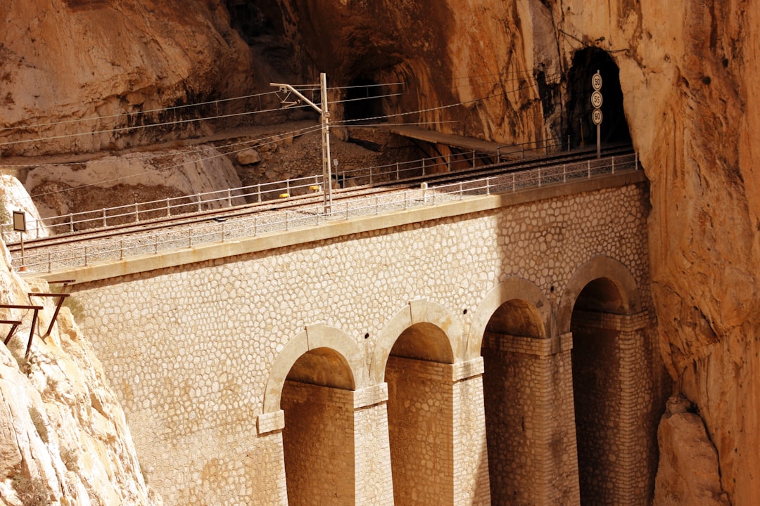
A walkway just over a meter wide, anchored to the limestone rock at dozens of meters high: this is the first impact with the King's Path, the route that crosses the gorges of El Chorro, near Ardales, in the province of Málaga. The path was built in the early 1900s to allow workers to move between the Chorro and Gaitanejo dams, which were then under construction. King Alfonso XIII walked it in 1921 during the inauguration of the Chorro dam, and from that moment the path took the name it still carries today.
After decades of abandonment and degradation, during which the path became sadly known as one of the most dangerous in the world, complete restoration work was completed in 2015. Since then, the King's Path has become an official and safe route, equipped with new wooden and steel walkways that run parallel to the original concrete remains, still visible in many points along the route.
The northern access from Ardales: what the route looks like
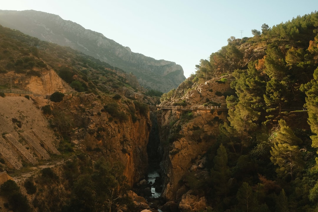
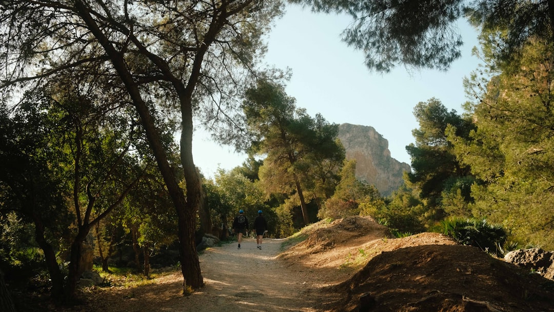
The northern entrance is located near the village of Ardales and is the recommended starting point for those traveling the trail in the most common direction, from north to south until the exit of El Chorro. After picking up the mandatory helmet at the visitor center, one enters a natural path that for the first few kilometers runs through Mediterranean scrub and limestone rock, with moderate slopes. This first section, called natural zone, allows the eyes to gradually adjust to the scale of the landscape before the path narrows and rises along the walls of the gorge.
It is along this initial part that one encounters the first glimpses of the artificial basins of the Guadalhorce, whose waters take on shades ranging from emerald green to intense turquoise depending on the season and the light. The limestone walls, rising in some places over a hundred meters, display clearly readable geological layers, with colors varying from light gray to ochre. Those who pay attention may notice traces of rock vegetation clinging to the crevices, including some species of wild orchids in spring.
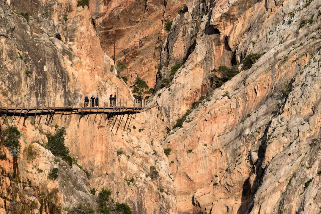
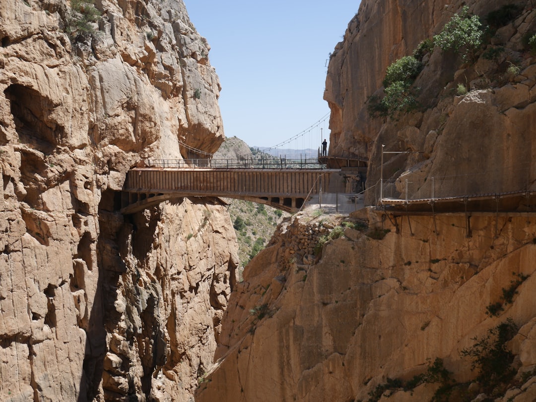
The suspended walkways: the heart of the path
The most spectacular section is that of the suspended walkways, where the path narrows to its minimum width and literally runs glued to the rock wall, at a height that in certain places exceeds 100 meters above the valley floor. The new structures made of treated wood and steel are solid and equipped with handrails on both sides, but the feeling of exposure to the void is real and not suitable for those who suffer from severe vertigo. Below the feet, through the floorboards, one can see the Guadalhorce river flowing between the rocks.
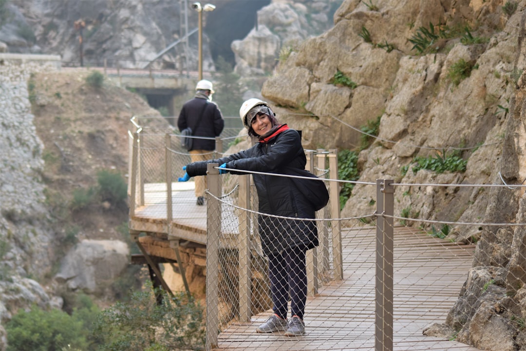
In this section, it is possible to closely observe the remains of the old original concrete path, which remains just above or next to the new structures. In some places, the original concrete is completely crumbled, which makes the contrast with the solidity of the new installations even more evident. Along the walls, one can often see birds of prey nesting, particularly the griffon, easily recognizable by its wingspan that can exceed two and a half meters.
Length, duration, and logistics of the route
The complete route from north to south measures about 7.7 kilometers, of which just under 3 constitute the section of walkways. The average duration to complete it is about four hours, including photo stops. The route is one-way, so those starting from the north access must arrange to return to Ardales from the south exit: there are paid shuttle services connecting the two points, or one can leave a second vehicle at the south exit.
Tickets are purchased exclusively online on the official Caminito del Rey website and sell out weeks in advance during the spring months and in October, which are the peak times. The cost of the basic ticket is around 10 euros per adult, to which the cost of the shuttle may be added. It is mandatory to show up with closed shoes with non-slip soles: sandals are not allowed at the entrance.
When to go and what to bring
The best season to visit the Caminito del Rey is spring, between March and May, when temperatures are mild, vegetation is lush, and the waters of the reservoirs reach their most intense color. Summer should be avoided not only for the heat, which can become suffocating in the gorge, but also because the path is temporarily closed in case of fire risk. In autumn, conditions are generally good, but rains can make the walkways slippery.
Bringing enough water is essential: there are no refreshment points or fountains along the route. A hat, sunglasses, and sunscreen complete the minimum equipment. A camera or smartphone is almost unnecessary to mention, but it is worth remembering that some of the most beautiful shots are obtained by looking back at the gorge you have just traversed, rather than always looking forward.