

During the ninth and tenth centuries from Bari, the seat of an Arab emirate from 847 to 871, the Arabs pushed into the interior of southern Italy, thus including Basilicata, to carry out looting and capture captives to sell as slaves in the centers of the Islamic empire, at that time in a phase of maximum expansion.
According to some chroniclers of the time and according to available sources, Arab settlements were substantial and long-lasting in many centers of the middle Bradano and Basento basins, in the Lower Potentino and the Agri Valley. The numerous architectural traces that can still be read in many historic centers and the linguistic traces in local dialects suggest that these were not exclusively military settlements, but real articulated communities, where a major role was played by merchants and artisans.
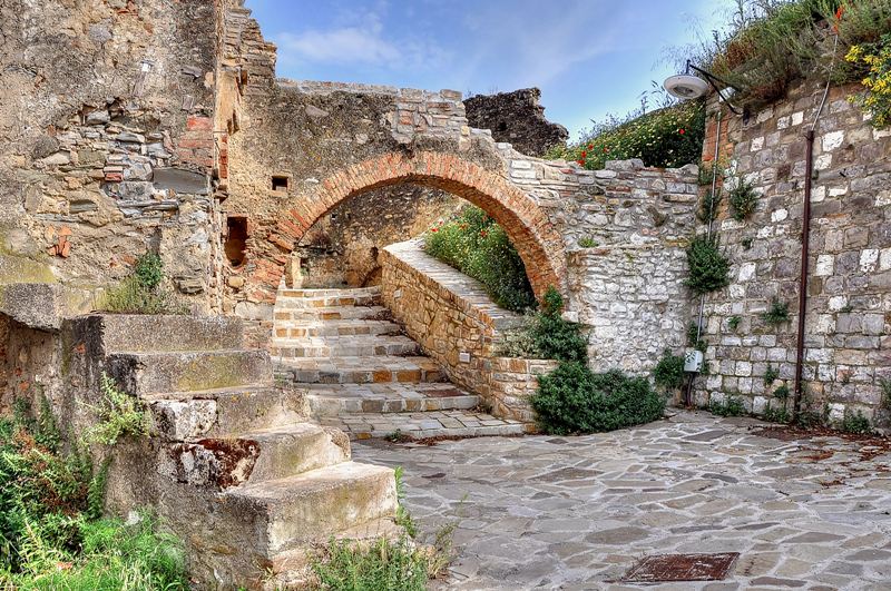
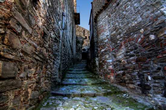
The traces of Arab settlements are still perfectly legible in Tursi, Tricarico and Pietrapertosa: these are neighborhoods that tradition appoints as Rabatana, Rabata or Ravata, etymologically recalling the term ribat, which in Arabic means a resting place or even a fortified place. For example, the two quarters of Rabata and Saracena, with their gateways and respective towers, dating back to the 11th century, are still legible in Tricarico. The settlement is divided in two by a narrow main street, the Arab shari, from which branch off secondary streets (darb), which intertwine with each other and end in blind alleys (sucac), which define neighborhood units quite distinct from each other; the individual housing units, often hypogeous, while tending to close themselves off defensively from the outside world, communicate with it through the sloping terraces, cultivated with vegetable gardens or orchards, arranged in a crown around the perimeter of the building fabric.
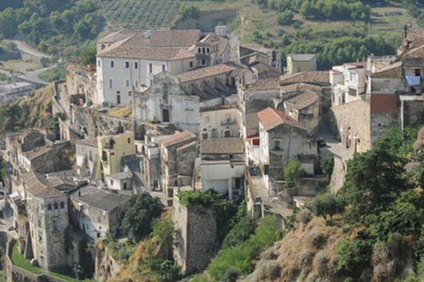
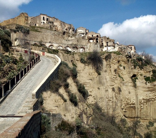
The Rabatana of Tursi coincides with the highest part of the early medieval settlement, in an excellent defensive position. The building tangle that still characterizes this neighborhood was dominated by the presence of the castle, of which few traces currently remain. La Rabatana is connected to the body of the village by a steep road (in dialect "a pitrizze"). The ancient Saracen village is inextricably linked to the dialect poetry of Albino Pierro.
In the cliffs below, testifying to the antiquity of the place, some olive-shaped lead balls have been found, with a small hole in one of the corners, with engravings in Greek and Latin, which were thrown at enemies with slingshots, by sharpshooters, by the Romans called marziobarbuli.
In the heart of the Rabatana stands the Collegiate Church of St. Mary Major, and, vulgarly called Madonna della Cona. Inside is a catacomb (Kjpogeum), Gothic in structure and adorned with sacred writings. The frescoes present, dating from the 16th century, can be traced back to Simone da Firenze and pupils of Giotto's school. Inside there is also a stupendous stone nativity scene made in the 15th century by an uncertain author (Altobello Persio or more likely Stefano da Putignano, author of the nativity scene present inside Altamura Cathedral).