← Back

Park of the City Walls

Genoa, Metropolitan City of Genoa, Italy ★★★★☆ 285 views
Marianna Totti
Genoa
🏆 AI Trip Planner 2026

Get the free app

Discover the best of Genoa with Secret World — the AI trip planner with 1M+ destinations. Get personalized itineraries, hidden gems and local tips. Free on iOS & Android.

🧠 AI Itineraries 🎒 Trip Toolkit 🎮 KnowWhere Game 🎧 Audio Guides 📹 Videos
Scan to download iOS / Android
Scan for AppGallery Huawei users

About Park of the City Walls

Park of the City Walls - Genoa | Secret World Trip Planner

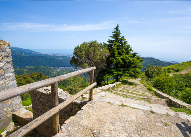
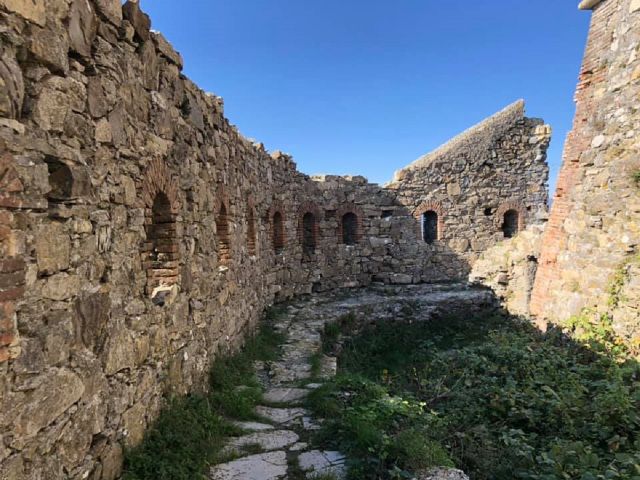
The Parco delle Mura (Park of the City Walls) is a Protected Natural Area of 617 hectares of hills that surrounds Genoa. It is named after the New Walls erected in the 17th century to protect the city and its harbour. Besides them, the area includes many military forts built betweeen 17th-19th centuries. There are different itineraries to follow, each of them runs through meadows, woods, pastures and remains of the area’s sheep-farming past.

Park of the City Walls - Genoa | Secret World Trip Planner

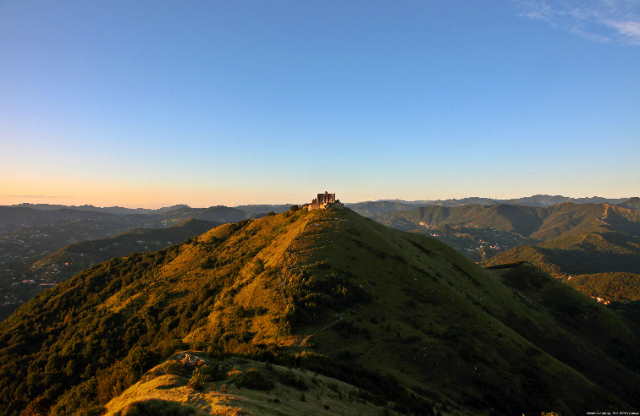
The most popular destinations are Forte Diamante, the Park’s highest and most isolated fort (660 metres above sea level), Forte Begato, overlooking Polcevera Valley, Fratello Maggiore and Minore, Puin, Sperone and Tenaglie.

Most of paths presents no or almost not particular difficulty, anyway a minimal amount of training is required. I personally recommend you to not trek during summertime due to high temperatures and sun exposure.

Park of the City Walls - Genoa | Secret World Trip Planner

Best access to Parco delle Mura is by funicular Righi or Genova-Casella Railway (get off at Trensasco).

🗺 L'app des trésors cachés

Plan your visit to Genoa

Suggested itinerary near Park of the City Walls

MAJ+
500.000+ travelers worldwide
  1. 🌅
    Morning
    Park of the City Walls
    📍 Genoa
  2. ☀️
    Afternoon
    Monumental cemetery of Staglieno
    📍 2 km · Genoa
  3. 🌆
    Evening
    The Monumental Cemetery of Staglieno
    📍 2.1 km · Genoa

Buy Unique Travel Experiences

Powered by Viator

See more on Viator.com

Explore nearby · Genoa

Frequently Asked Questions

Avoid trekking during summertime due to high temperatures and sun exposure. Spring and autumn are ideal seasons for exploring the park's 617 hectares of hills, meadows, and woods without the intense heat.
The best access is by taking the funicular Righi or the Genova-Casella Railway, getting off at Trensasco station. Both options provide convenient entry points to the park from the city.
The top destinations include Forte Diamante, the park's highest and most isolated fort at 660 meters above sea level, plus Forte Begato which overlooks Polcevera Valley, and the forts of Fratello Maggiore, Fratello Minore, Puin, Sperone, and Tenaglie.
The park is named after the New Walls erected in the 17th century to protect Genoa and its harbour, with the area also featuring multiple military forts constructed between the 17th and 19th centuries. These fortifications remain prominent features throughout the protected natural area.
Most paths present no or almost no particular difficulty, making them accessible to beginners, though a minimal amount of training is still recommended. The trails wind through meadows, woods, and pastures, offering varied scenery across the 617-hectare park.